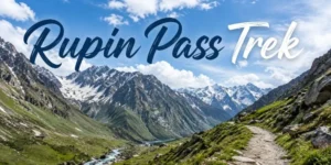
Rupin Pass Trek is a dramatic 7–8 day, 40–52 km high-altitude crossover that takes you from the forested villages of Uttarakhand to the cinematic Sangla Valley in Himachal Pradesh, crossing a 4,650 m (15,250 ft) pass en-route. It is graded difficult, with long summit days, steep snow gullies and rapid altitude gain, yet it rewards trekkers with one of the most varied Himalayan itineraries: deep pine forests, remote Garhwali and Kinnauri villages, the iconic three-stage Rupin Waterfall, alpine meadows, snow bridges and a sweeping descent into the Kinnaur landscape. Best done in May–June and September–October, it is a favourite among experienced weekend trekkers from Delhi, Chandigarh and Shimla who want a true pass-crossing adventure.
Rupin Pass Trek Overview
Rupin Pass is a classic “crossover” trek, meaning you start in one state and finish in another, with the Rupin River acting as your constant companion. The route begins around Dhaula or Jiskun in Uttarakhand, climbs through forest and hanging villages into a high valley dominated by the Rupin Waterfall, then tackles a steep snow or scree gully to the pass before dropping into the Ronti Gad and Sangla side in Himachal. Because the trail traverses remote, largely uninhabited stretches and crosses a high pass, it demands good fitness, prior high-altitude experience and respect for weather and snow conditions.
Trek Highlights
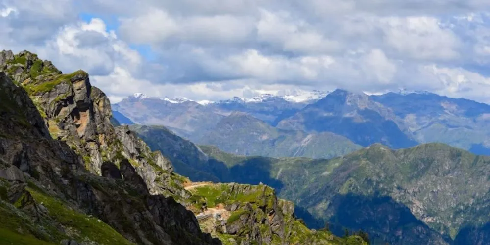
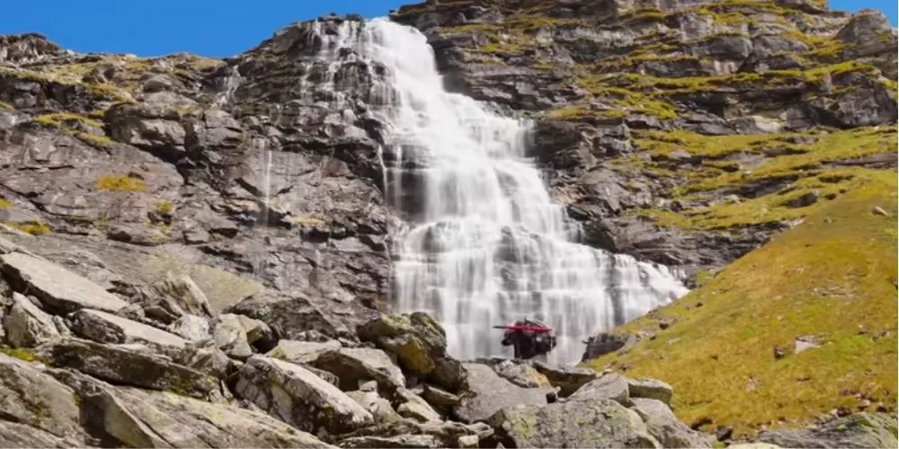
The trek’s signature highlight is the three-stage Rupin Waterfall, which appears as a towering white ribbon against dark rock and becomes more dramatic as you climb alongside it. Hanging villages like Jakha, perched on narrow ridges with sheer drops, offer a striking glimpse into mountain life, while the upper meadows around Saruwas and Dhanderas Thatch feel like open amphitheatres beneath towering peaks. Summit day brings the thrill of a snow gully ascent, crossing snow bridges over the hidden river and finally standing on the pass with views stretching into both Uttarakhand and Kinnaur.
Quick Facts: Rupin Pass sits at about 4,650 m (15,250 fi), with the trek usually starting around 1,500–1,600 m and ending near 2,600–2,700 m in Sangla. Total trekking distance is typically 40–52 km over 6–7 trekking days, depending on the exact itinerary and trailhead used. The route is graded difficult and is best suited to trekkers who have already done at least one or two high-altitude treks. Most plans begin and end with road transfers from Dehradun or Shimla.
How to Reach Rupin Pass
By Air: The nearest airports are Jolly Grant Airport, Dehradun, and Shimla Airport. From Dehradun, you drive towards Purola, Mori and Dhaula; from Shimla, you head towards Narkanda, Bawta and Jiskun or Sangla, depending on the route variant.
By Rail: Dehradun and Kalka are the main railheads, with Kalka connecting to Shimla via the toy train or road. From either station, you continue by bus or taxi to the trek’s road-head via Dehradun–Mori or Shimla–Narkanda–Bawta route.
By Road: Road access follows two common corridors: Dehradun → Mussoorie → Purola → Mori → Dhaula, or Shimla → Narkanda → Bawta → Jiskun/Sangla. Both routes are long mountain drives of 8–10 hours, usually done as an arrival or departure day in the itinerary.
To Base Camp: The functional base camps are Dhaula or Jiskun on the Uttarakhand side, and sometimes Bawta on the Himachal side, depending on the operator. Most groups reach the base camp by late afternoon on Day 1, rest, and start the trek the next morning.
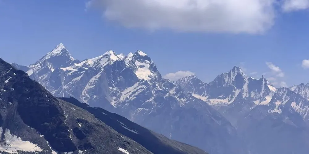
Trek Route & Trail Information
The classic route runs Dhaula/Jiskun → Sewa → Jakha → Saruwas Thatch → Dhanderas Thatch
→ Upper Waterfall Camp → Rupin Pass → Ronti Gad → Sangla.
Early days follow forested trails along the Rupin River, passing Garhwali villages and terraced fields before the valley narrows and the waterfall comes into view. The upper section climbs beside the waterfall to high meadows, then into a steep gully (snow in early season, scree later) that leads to the pass and a long descent into the Kinnaur landscape.
Day-wise Itinerary
Day 1: Road transfer from Dehradun or Shimla to the trek base (Dhaula, Jiskun or Bawta, depending on the route). Reach by late afternoon, check into camp or guest house, meet the trek team and rest for the climb ahead.
Day 2: Begin the trek from the road-head and follow the Rupin River through pine and oak forests, passing small Garhwali hamlets and terraced fields. Camp at Sewa or the first designated campsite after a few hours of steady walking.
Day 3: Continue upstream through denser forest and narrow valley sections, climbing gradually to the hanging village of Jakha. The trail offers dramatic views of the gorge and distant peaks before you set up camp near the village.
Day 4: Leave Jakha and ascend into more open terrain as the valley widens, moving towards Saruwas Thatch and then Dhanderas Thatch. These high meadows feel like natural amphitheatres, with the Rupin Waterfall growing more prominent on the horizon.
Day 5: Climb alongside the iconic three-stage Rupin Waterfall to Upper Waterfall Camp. The day is shorter but steep, designed to position you close to the pass for an early start on summit day.
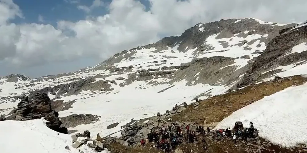
Day 6: Summit day: start before dawn and tackle the steep snow or scree gully leading to Rupin Pass. After crossing the pass, descend into Ronti Gad, with long hours on your feet but rewarding views into both Uttarakhand and Kinnaur. Camp at Ronti Gad or the designated high camp.
Day 7: Descend from Ronti Gad towards Sangla in Himachal Pradesh, passing Kinnauri villages and dramatic valley scenery. From Sangla, drive back to Shimla or continue onward to Dehradun, marking the end of the trek.
Best Time to Visit Rupin Pass
Rupin Pass is best attempted in May–June and late September–October. May–June offers stable weather, good snow cover for the gully and clear views, making it the most popular window. Autumn brings crisp air, post-monsoon clarity and dramatic colours in Kinnaur, though snow may be less predictable and the gully can be rockier. Monsoon and deep winter are generally avoided due to landslide risk, heavy snow and route closures.
Permits & Entry Fees
Rupin Pass traverses forest and wildlife zones in both Uttarakhand and Himachal Pradesh, so forest entry fees and trekking permits are usually required. Most organised operators arrange these permits as part of the package, including any local village or camping charges. Independent trekkers should check current rules with the forest department or local operators, as requirements can change by season.
Trekking Essentials (What to Pack)
Carry a 50–60 L backpack with rain cover, plus a small daypack for summit day if your main luggage is portered. Essential clothing includes moisture-wicking t-shirts, 2–3 trekking pants, thermal innerwear, a warm fleece, a down or padded jacket, and a waterproof shell jacket and pants. Add 3–4 pairs of woollen/synthetic socks, warm gloves plus waterproof gloves, a woollen cap, sun cap and a buff. High-ankle waterproof trekking shoes, trekking poles, headlamp with spare batteries, UV sunglasses, sunscreen SPF 50+, lip balm, basic first aid, personal medicines, toiletries, a 1–2 litre water bottle and a power bank round out the core kit.
Important Tips: Treat Rupin Pass as a serious high-altitude trek: build cardio and leg strength beforehand, and do not attempt it as your very first mountain trek. On summit day, start early, follow your guide’s line closely in the snow gully and avoid wandering off the marked path, especially over snow bridges. Helmets are often provided for the gully section; wear them and stay alert for falling rock in late season. Pack light but warm, use rain covers and dry bags, and keep important items like ID, medicines and a warm layer easily accessible.
Places to Visit Nearby
On the Himachal side, Sangla Valley, Kamru Fort and the drive towards Chitkul offer striking Kinnauri landscapes and ancient temples (Sangla is about 80–90 km from Shimla; from Chitkul roughly 110–120 km from Shimla). Narkanda and Hatu Peak on the Shimla–Sangla route make good acclimatisation or recovery stops with forest walks and views (Narkanda is around 60–65 km from Shimla; Hatu Peak just above Narkanda). On the Uttarakhand side, a halt in Dehradun or Mussoorie before or after the trek adds cafes, markets and easy transport connections (Dehradun is about 220–240 km from the Uttarakhand trailheads; Mussoorie is roughly 240–260 km from Dhaula/Mori).
Conclusion
Rupin Pass Trek stands out as one of India’s most dramatic crossover adventures, combining remote villages, a towering waterfall, high meadows and a challenging pass crossing into a single, unforgettable itinerary. For trekkers ready to invest in fitness, respect altitude and follow safe practices on snow and gullies, it delivers a rare sense of journey, leaving one world behind and stepping into another over the spine of the Himalayas.
By: Anushka Singhal
Also Read: Chandrashila Trek: The “Moon Rock” Summit Above Tungnath