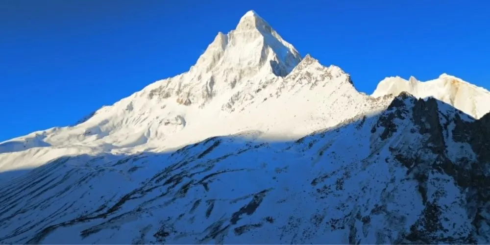
Gaumukh Tapovan Trek is a 5–7 day, 46–50 kms high-altitude journey in Uttarkashi district of Uttarakhand that takes you from the pilgrimage town of Gangotri (3,048 m) to the glacial snout of Gaumukh (~4,050 m) and further up to the alpine meadows of Tapovan (~4,460–4,463 m). It combines a physical approach to the Bhagirathi/Gangotri glacier, the mythic “cow’s mouth” source of the Ganga, and a contemplative stay in Tapovan’s grasslands under towering Himalayan giants such as Shivling, Meru and the Bhagirathi peaks. The trail starts as a well-cut forest path frequented by pilgrims, then shifts to moraine, boulder fields and glacier edges, making the trek moderate to difficult; manageable up to Gaumukh for fit beginners, but requiring solid fitness and prior experience for the steep, rough climb to Tapovan.
Trek Overview
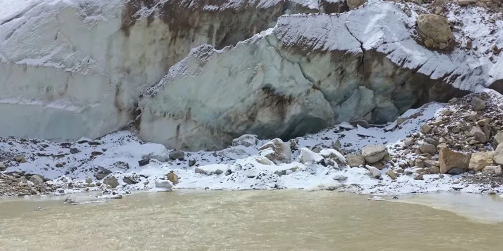
The Gaumukh Tapovan Trek begins from Gangotri and follows the Bhagirathi River through the protected landscapes of Gangotri National Park. The trail gradually transitions from deodar and pine forests to birch groves, rocky moraines, and glacial terrain before reaching Gaumukh, the snout of the Gangotri Glacier and the sacred source of the Bhagirathi River. From here, a challenging climb over boulders leads to Tapovan, a vast alpine meadow surrounded by towering Himalayan peaks, making the trek a perfect blend of spirituality, adventure, and breathtaking mountain scenery.
Trek Highlights
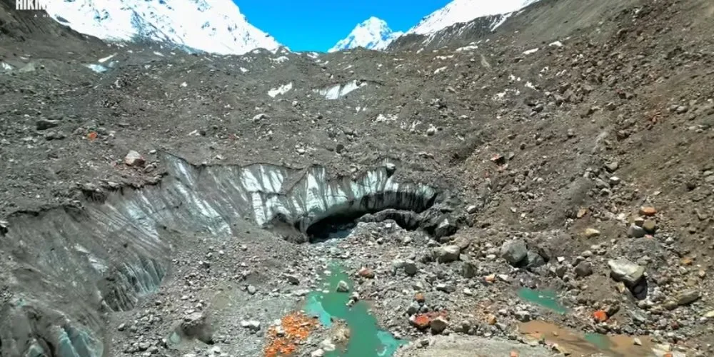
Witness the awe-inspiring sight of the Bhagirathi River emerging from the Gangotri Glacier at Gaumukh before ascending to the spectacular meadows of Tapovan, nestled beneath the iconic Mt. Shivling. The trek rewards you with panoramic views of Meru, the Bhagirathi massif, and surrounding snow-clad peaks, while scenic campsites like Chirbasa and Bhojbasa offer serene valley views. The presence of ancient ashrams and sadhus further adds to the trek’s peaceful and spiritual charm.
Quick Facts
- Starting Point: Gangotri (3,048 m)
- Maximum Altitude: Tapovan (4,463 m)
- Trek Distance: Approximately 46–50 km (round trip)
- Duration: 5–7 days
- Difficulty: Moderate (up to Gaumukh); Moderate to Difficult (Gaumukh to Tapovan)
- Location: Gangotri National Park, Uttarakhand
- Permit: Mandatory, with limited daily entries
How to Reach
By Air: The nearest airport is Jolly Grant Airport, Dehradun, about 240–250 kms from Gangotri. From the airport you can take a taxi to Uttarkashi and onward to Gangotri, or first move to Rishikesh and then catch hill transport. Expect 8–10 hours of mountain driving to reach Gangotri in good conditions.
By Rail: Haridwar and Dehradun are the main railheads for the region, both well connected to Delhi and other big cities. From either station, you continue by bus or shared jeep to Uttarkashi and then on to Gangotri, usually breaking the journey with a night stop or long single push of 9–12 hours depending on traffic and road works.
By Road: Road access follows the Bhagirathi valley: most trekkers start from Rishikesh or Dehradun and drive via Chamba, Uttarkashi and Harsil to Gangotri, covering ~240 kms in 9–10 hours. Regular ATC/GMVN buses and shared Sumos operate in season between Rishikesh, Uttarkashi and Gangotri, while many trekking groups use reserved tempo travellers for reliability and gear space.
To Base Camp: The functional base camp is Gangotri town, at about 3,048 m on the banks of the Bhagirathi. Most operators ask you to report here one day before the trek for acclimatisation, briefing and permit verification, staying in a GMVN guest house or local lodge before you step onto the national park trail.
Trek Route & Trail Information
The classic route runs Gangotri → Chirbasa → Bhojbasa → Gaumukh → Tapovan and then returns by largely the same track.
From Gangotri, a well-built path follows the true left of the Bhagirathi through mixed forest and cliff traverses to Chirbasa (about 9 kms), a pine-lined rest point with first open views of the upper valley. The trail then continues 4–6 kms to Bhojbasa, where the valley widens, the birch slopes appear and you get the first close look at the snout of the Gangotri Glacier. Beyond Bhojbasa the route becomes rockier and more exposed; you follow moraine and rough tracks for 4–5 kms to Gaumukh, then tackle a steep 4–6 kms climb over boulders and broken glaciers to reach the Tapovan meadows high above the ice.
Day-wise Itinerary
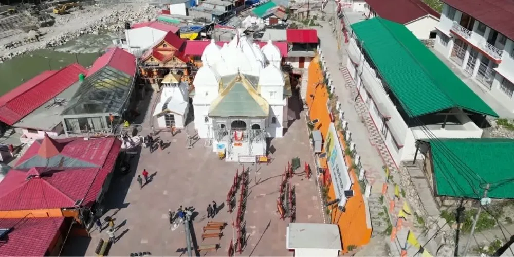
Day 1: Road transfer day from Dehradun/Rishikesh to Gangotri, roughly 245 kms in 9–10 hours, ending in a guest house stay and temple visit.
Day 2: Usually covers Gangotri to Chirbasa (around 9 kms, 4–5 hours), a gentle but steady walk at 3,400–3,500 m along the river with mixed forest and valley views.
Day 3: Goes from Chirbasa to Bhojbasa (6 kms, 4–5 hours), gaining a few hundred metres of height over looser terrain and reaching one of the main intermediate bases with GMVN huts, ashrams and tent platforms.
Day 4: You push from Bhojbasa up to Tapovan, either via a short halt at Gaumukh or in one continuous effort, about 8–10 kms over 7–8 hours, starting with the approach to the glacier and then tackling the steep boulder and moraine climb onto the Tapovan shelf.
Day 5: It is often a rest/exploration day in Tapovan, with sunrise photography, short walks towards Meru or the upper glacier and time at Mauni Baba’s ashram. Descent usually takes two days: Tapovan back to Bhojbasa via Gaumukh (6–8 kms, 5–7 hours) and then Bhojbasa down to Gangotri (12–14 kms, 6–7 hours), skipping Chirbasa on the way out. A final road day moves you back to Rishikesh/Dehradun for onward travel.
Best Time to Visit
Gaumukh Tapovan is best trekked in summer (May–June) and autumn (September–October). In May–June, the park opens fully, meadows turn green, and the trail is lively with pilgrims heading to Gaumukh; temperatures are milder and snow patches remain at higher sections. September–October brings clearer skies, crisper air and far fewer pilgrims, giving trekkers emptier trails and sharp views across the Gangotri basin, though nights are colder and the window is only 4–5 weeks long. Monsoon months (July–August) are not recommended because of landslides, slushy paths and rockfall, while deep winter snow and park closures make December–March unsuitable except for serious expeditions.
Permits & Entry Fees
Gaumukh Tapovan lies inside Gangotri National Park, which enforces daily limits on the number of trekkers and pilgrims entering beyond Gangotri. You need a forest/national park permit for the Gaumukh trail and an additional endorsement if you plan to camp at Tapovan; these are issued by the Forest Department at Uttarkashi or Gangotri against ID and fixed fees per person per day. Operators usually secure group permits in advance, but independent trekkers must apply early, especially in peak May–June, as same-day Tapovan approvals can be difficult. Plastic is officially banned inside the park and camping is restricted to designated areas like Bhojbasa and Tapovan to protect the fragile glacial ecosystem.
Trekking Essentials (What to Pack)
Backpack: 50–60 L trekking backpack with rain cover.
Footwear: High-ankle trekking shoes with good grip and gaiters (recommended during snow or slush).
Clothing: Quick-dry T-shirts, trekking pants, thermal wear, fleece layers, a warm padded jacket, woollen socks, gloves, a woollen cap, and a buff.
Rain Protection: Waterproof jacket, rain pants, or poncho.
Accessories: UV-protected sunglasses, trekking poles, headlamp with spare batteries, and a power bank.
Food & Hydration: Reusable water bottles or hydration bladder, energy bars, dry fruits, nuts, and ORS.
Medical Kit: Personal medicines, blister care, bandages, antiseptic, pain relievers, and altitude medication (only on medical advice).
Documents: Valid photo ID, permit copies, and sufficient cash, as ATMs and charging facilities are unavailable beyond Uttarkashi/Gangotri.
Important Tips
- Spend at least one night in Gangotri to acclimatise before starting the trek.
- Hire a local guide for the Gaumukh–Tapovan section, as glacier and moraine routes change every season.
- Start trekking early each morning to avoid afternoon weather changes and reach camp before dark.
- Follow Gangotri National Park regulations by avoiding plastic and carrying back all your waste.
- Book GMVN accommodation or campsites in advance, especially during peak trekking season.
- Mobile connectivity is limited beyond Gangotri, so inform your family before starting the trek.
Places to Visit Nearby
- Gangotri: Visit the sacred Gangotri Temple, riverfront ghats, and the picturesque Bhagirathi Valley.
- Harsil (25 kms): A peaceful Himalayan village known for its apple orchards, pine forests, and riverside scenery.
- Uttarkashi (100 kms): Explore ancient temples, local markets, and use it as a base for trekking permits and supplies.
- Rishikesh (270 kms): Unwind with the Ganga Aarti, riverside cafes, yoga centres, and adventure activities like river rafting.
Conclusion
Gaumukh Tapovan Trek feels less like a routine hike and more like a journey to the heart of the Himalayas. Standing at Gaumukh, watching the first waters of the Ganga emerge from the glacier and then looking up at Shivling from the quiet meadows of Tapovan, you see why this trail is treated as both adventure and pilgrimage. For trekkers who have the fitness for a moderate–difficult route and the patience to respect permits, park rules and the fragile glacial environment, Gaumukh Tapovan offers a rare blend of spiritual depth, raw mountain scenery and high-altitude challenge that tends to stay with you long after you’ve descended back to Gangotri.
By: Anushka Singhal
Also Read: Kuari Pass Trek: Lord Curzon’s Classic Window to Nanda Devi